 RotorLab
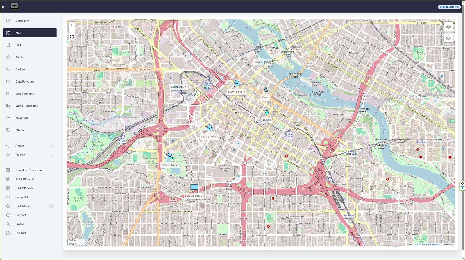
Connect any MAVLink ground station to ATAK and your TAK server. Every aircraft appears on the tactical map as a live MIL-STD-2525 track, parented to your GCS and updating continuously. And it is two-way — drop a named marker in ATAK and the bridge flies the drone. No custom integration, no scripting.
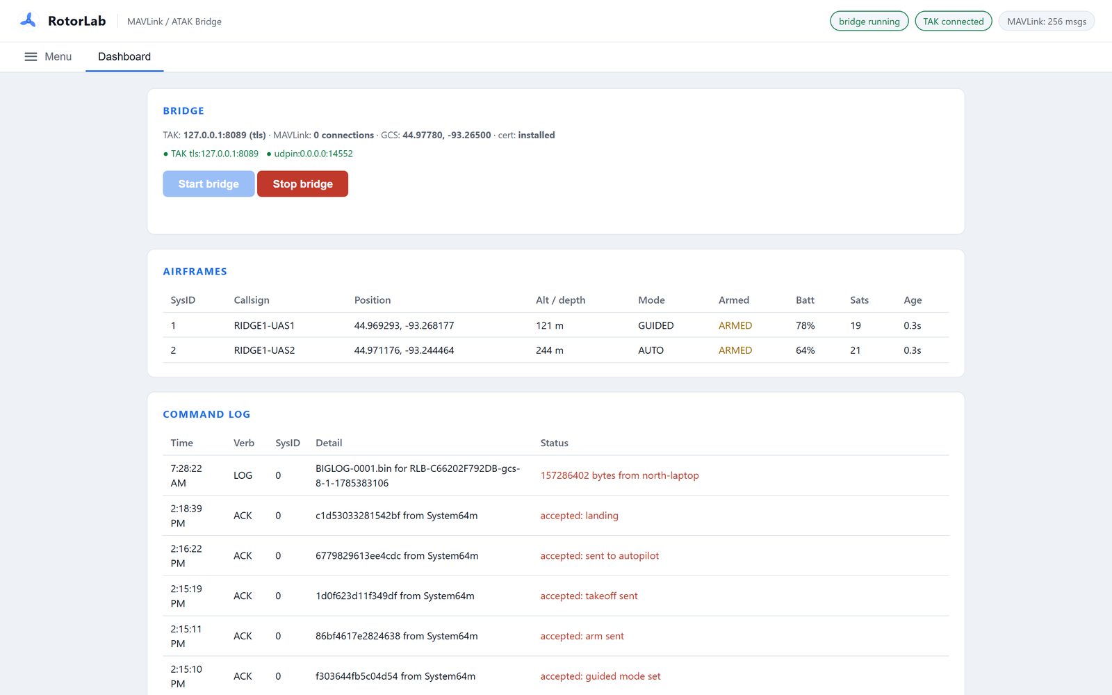
It does not just watch. Drop a named map marker and the bridge flies the drone — and every verb is something you switch on deliberately.
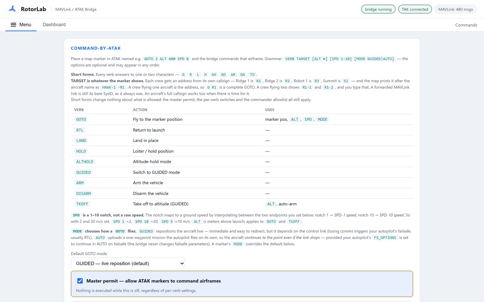
Position, altitude, speed, heading, flight mode, armed state, battery, and GPS — per aircraft, updating continuously.
Run UDP, TCP, and serial links at once. Works with MAVProxy, QGroundControl, Mission Planner, ArduPilot, PX4, and SITL. One install, unlimited aircraft.
Publishes to your TAK server, or broadcasts direct to ATAK over mesh or multicast. Nothing proprietary in the middle.
One-click certificate enrollment for OpenTAKServer, or import your own PEM or PKCS#12 when your organization issues its own.
Light and dark themes, role-based logins — admin and read-only viewer — and optional organization branding.
Windows or Linux, lightweight, and no cloud dependency. It works on a network that never reaches the internet.
Flight physics, fleet operations and what shipped — written for people who fly. No spam, unsubscribe in one click.